

151·
2 months agoAnd the “free” means “freedom”, it doesn’t mean “no price”
And the “free” means “freedom”, it doesn’t mean “no price”

It’s been a long time since I kept up with Bungie and had to look back because the name Luke Smith rang a bell.
It led me back to this and he indeed is who I thought he was, the lead of this old song

Under “Assets” on their Github Release page, they have two APKs listed. One is a web version and the other is a google version.
https://github.com/organicmaps/organicmaps/releases
I did some experimenting and it seems like only the google version has Android Auto.
Organic Maps and OsmAnd both have Android Auto support.
Everything that exists in OpenStreetMap is from tiny drops

In the open source world, I take that as a highlight, not a warning.

In Canadian terms, the Liberal part just got a majority after a long stretch of Conservative leadership, the ones that broke from NAFTA.
Something of concern is that the People’s Party actually got seats this election, even more than the Bloc. And the Green part got another seat, so there’s that.

This app is everything it needs to be. It looks modern, has nice visuals, I was able to import data from an old tracking app.
It’s such a nice feeling when you find an app that hits all the checkmarks and then you find out it’s FOSS as well.

Well that’s egg on my face.
You’re on the wrong instance for that
What does “half Jewish half Irish” even mean?
One parent is Irish and the other is Jewish.

I’ve been trying to find some good examples of how to structure the files, and whether to combine the photos from everyone or to keep them separate. Obviously there’s different systems for everyone, but your method of syncing, tagging, and displaying/sharing photos is almost identical to how I’ve been wanting to go about it.
Do you mind sharing how you structure the photo files and naming in your Gallery directory?
I was thinking of implementing the Copyright tag to keep the data of the original phototaker, and then combine all the photos into a Gallery/YYYY/MM structure, with the filenames being YYYYMMDD-CameraModel.
There aren’t many events we go to, so albums aren’t a big priority, but on the occasion, I was thinking if using a folder like MM-Event in the respective year folder.
I’m just putting my thoughts down because I don’t often see this part of people’s photo organizing.
Maps are for documenting the location of things in the real world relative to each other. It could be anything, like roads and buildings, or rivers and bodies of water, or electrical lines.
Then there is all the information that is added to all those objects; adding names to the roads, buildings having an addtess and what type of building they are, the direction a river is flowing and how many rivers flow into or out if a lake.
All of that is just information, where an what things are, it doesn’t actually do anything. That is a map.
Navigation software takes the information about the roads and how they are connected together along with their names and combines it with addresses to show you how to get from one address to another.
You could also have software that simulates the ecological effects of rerouting a river from a lake, or damming a river.
You could take data from a map to show you all the power lines that are near trees that will need to be trimmed and give estimates to your employer on how many people to hire for tree trimming, and then combine that with a map of buildings to show how many customers would be without power if a tree branch triggers a circuit to open.
Navigation is just one part of what a map could be used for, and probably one of the only parts that most people would use a map for.
OpenStreetMap started out just being a map of streets, hence the name, but it has grown to be this massive collection of information. Then there is all of tools that decide what to do with the information. OsmAnd is a good tool for simply displaying the data. It can provide navigation but it’s not the best.
I’ve gotten a number of calls from clients recently where a Windows update uninstalled the Bluetooth drivers, making their Bluetooth mouse and keyboard unusable.
I’ve even had a few where an update uninstalled the WiFi drivers so they couldn’t even download the drivers without a wired network connection.
It’s one thing if you’re processing and doing work with the data but Reddit will be getting $60,000,000 a year for simple having the data.
And what value is a commodity that is available to everyone?
I don’t disagree with your point but I’m sure it couldn’t be sold for as much as when it’s a limited resource.

N 6th E St
E 6th N St
Yeah, not a fan.
That’s just the road continuing in a weird way.
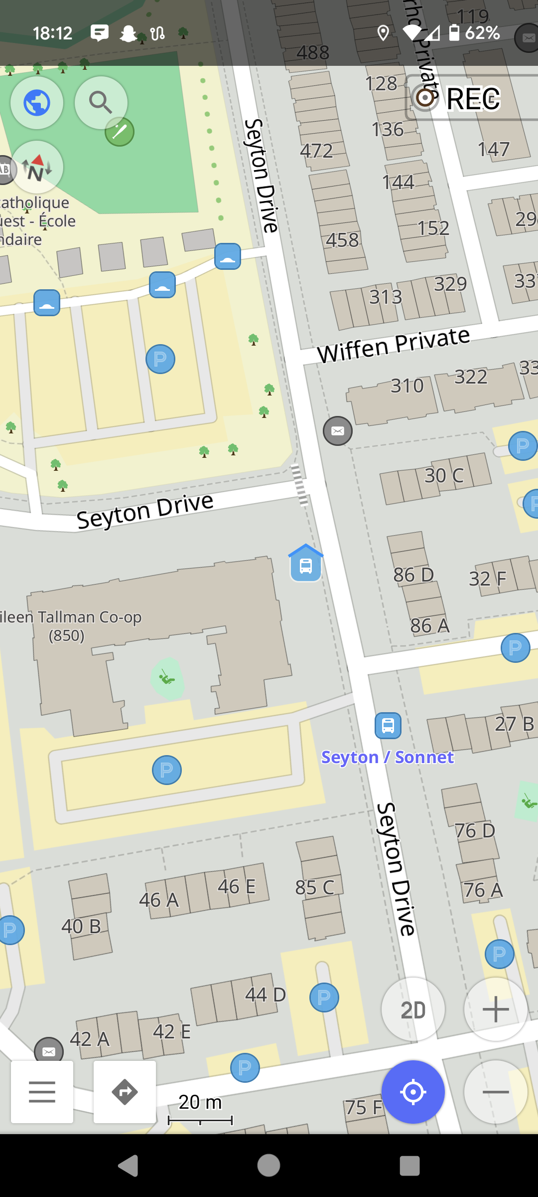
Try this one, Seyton Dr. intersecting with Seyton Dr.
This looks like a very large Canadian house hippo


The app mentioned on the post, Organic Maps, has Android Auto. OsmAnd is another app that I know has it as well.